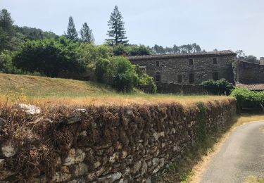
Randonnée Marche La Grand-Combe - sentier découverte LA GRAND COMBE - Photo

sentier découverte LA GRAND COMBE

 CAMBON
CAMBON

Utilisateur

© OpenStreetMap contributors
Longueur
Longueur
8,3 km
Altitude max
Altitude max
442 m
Dénivelé positif
Dénivelé positif
284 m
Km-Effort
Km-Effort  
12,1 km
Altitude min
Altitude min
192 m
Dénivelé négatif
Dénivelé négatif
282 m
Boucle
Boucle
Oui
Date de création :
2019-01-15 12:31:17.039
Dernière modification :
2019-01-15 12:31:17.039

(0 Avis)

Marche
Marche
2h33
Difficulté : Moyen

Scannez ce code QR pour ouvrir la randonnée dans l'application SityTrail

Application GPS de randonnée GRATUITE

Logo SityTrail SityTrail

IGN / Instituts géographiques

Télécharger SityTrail sur l'App Store Télécharger SityTrail sur Google Play

Logo SityTrail SityTrail World

Le monde est à vous

Télécharger SityTrail sur l'App Store Télécharger SityTrail sur Google Play Télécharger SityTrail sur Huawei AppGallery

À propos

Randonnée Marche de 8,3 km à découvrir à Occitanie, Gard, La Grand-Combe. Cette randonnée est proposée par CAMBON.

Description

sentier découverte au départ de la grand combe

Profil altimétrique

Localisation

Pays :
France
Région :
Occitanie
Département/Province :
Gard
Commune :
La Grand-Combe
Localité :
Unknown
Départ:(Dec)
Départ:(UTM)
582137 ; 4895746 (31T) N.

Randonnées à proximité

Randonnée Marche Soustelle - Le Roubarbel Le Galaizon - Photo
Marche
GUIDE
Roger Philippe Wallez

Marche

Difficile
Soustelle, Occitanie, Gard, France
11,7 km | 17,1 km-effort
3h 16min
Non
Randonnée Marche Saint-Martin-de-Valgalgues - Crématorium - Le Mas Dieu - Fontaine des Mamans - Carboussede - Crématorium - Photo
Marche
Khoe Khoe

Marche

Moyen
Saint-Martin-de-Valgalgues, Occitanie, Gard, France
10,1 km | 13,6 km-effort
2h 42min
Oui
Randonnée Marche Saint-Martin-de-Valgalgues - LE MAS DIEU - Photo
Marche
bernardgouttiere

Marche

Moyen
Saint-Martin-de-Valgalgues, Occitanie, Gard, France
8,5 km | 11,6 km-effort
2h 36min
Oui
Randonnée Marche Sainte-Cécile-d'Andorge - SAINTE CÉCILE D'ANDORG - Photo
Marche
bernardgouttiere

Marche

Facile
Sainte-Cécile-d'Andorge, Occitanie, Gard, France
6,9 km | 10,2 km-effort
2h 2min
Oui
Randonnée Marche Soustelle - vallée Galeizon - Photo
Marche
GUIDE
nadinebondoux

Marche

Moyen
Soustelle, Occitanie, Gard, France
10,5 km | 15,2 km-effort
3h 51min
Non
Randonnée Marche Soustelle - sentier du rocher de sallele  - Photo
Marche
olivier78000

Marche

Moyen
Soustelle, Occitanie, Gard, France
12,2 km | 17,5 km-effort
3h 44min
Oui
Randonnée Marche Laval-Pradel - Mas Dieu- Vézénobre - Photo
Marche
dagobert5612

Marche

Facile
Laval-Pradel, Occitanie, Gard, France
25 km | 29 km-effort
5h 38min
Non
Randonnée Marche Portes - 30_Affenadou_Ales_regordane_j7_realise - Photo
Marche
jab31

Marche

Moyen
Portes, Occitanie, Gard, France
22 km | 27 km-effort
5h 45min
Non
Randonnée Marche La Grand-Combe - sentier découverte  - Photo
Marche
access

Marche

Facile
La Grand-Combe, Occitanie, Gard, France
8,8 km | 12,3 km-effort
2h 23min
Oui


Fermer
Mes abonnements